
万锦
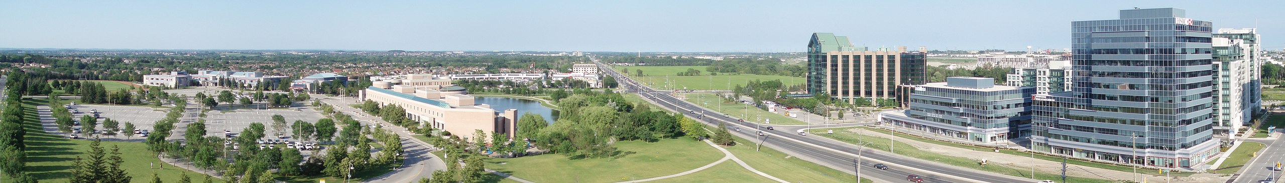
万锦是位于多伦多以北的郊区城市,在安大略省,加拿大。它包含现已成为历史街区的历史村庄联合村,并且可以为旅行者提供一些更便宜的住宿选择,如果您不介意距离多伦多的景点较远。
了解
[]万锦是众多科技公司总部的所在地,包括显卡制造商ATI Technologies、摩托罗拉、IBM软件实验室和Sun Microsystems(确切列表可能会随着公司被竞争对手收购而变化)。该镇的口号“卓越的标志”和“加拿大的高科技之都”得到了充分体现,这里拥有多元文化社区、各种活动和景点,并融合了老城怀旧与现代高科技生活。2021年,其人口接近34万。
主街
[].jpg)
请注意,万锦市有两条名为“主街”的街道,它们位于城市的不同区域。万锦主街基本上与万锦路相同,南北穿过城市旧城镇中心,该中心称为万锦村。“主街北”是“万锦主街”的更具体名称。各种地图可能将这条街道标识为“万锦路”以及“主街北”或“万锦主街”。(7号公路以南有一条“主街南”,但它不如主街北有趣。)联合村主街位于万锦主街以西,南北穿过联合村的历史街区。这两条主街相距超过4公里,并且都在南部靠近7号公路处交叉。
历史街区
[]万锦市有三个历史街区,那里聚集着19世纪的建筑。它们是
- 联合村主街是三个历史街区中最具古朴魅力的地方,南部是住宅区,北部是商业区(主要是餐馆)。
- 万锦主街(又名万锦村)仍然保留着万锦宜人的小镇中心,有许多历史建筑与现代建筑交织。万锦主街比联合村主街有更多的购物机会。两者都有一些餐馆。
- 索恩希尔沿着科尔本街(Colborne Street)有一片历史建筑,这是一条古朴的住宅街道。这个历史街区附近有几家餐馆,几乎没有购物机会。虽然联合村主街和万锦主街可能各值一天的游览,但索恩希尔主要是一个短暂的停留。索恩希尔的优势在于它是三个街区中最容易从芬奇车站(Finch Station)到达的。
旅游信息
[]- 万锦旅游局网站
抵达
[]乘飞机
[]位于密西沙加的多伦多皮尔逊国际机场(YYZ IATA)是最近的主要机场。
乘巴士
[]通过交通工具
[]从多伦多到万锦的公共交通通常始于1号线央街-大学线芬奇车站(Finch Station),然后转乘约克区交通(York Region Transit),该机构提供约克区巴士服务(包括Viva特快巴士),服务于万锦以及约克区的其他社区,如纽马克特和东吉林伯里。
但是,如果您要参观太平洋购物中心(Pacific Mall),乘坐公共交通前往这些购物中心的最佳方式是乘坐TTC 53路(Steeles East),该路线从1号线芬奇车站(Finch Station)出发。如果您前往东部地区,从2号线布鲁尔-丹佛线和3号线士嘉堡线上的肯尼迪车站(Kennedy Station)北上的TTC 43路(Kennedy)可能对您更有用。
前往联合村主街,请从芬奇车站乘坐Viva Blue巴士前往列治文山中心总站(Richmond Hill Centre Terminal)。从那里,乘坐Viva Purple巴士(标志为Markville/Stouffville Hospital而非Enterprise)或YRT 1路巴士前往联合村主街;过马路到北侧进入历史街区。
前往万锦主街(又名万锦村),请从芬奇车站乘坐Viva Blue巴士前往列治文山中心总站。然后,转乘Viva Purple(标志为Markville/Stouffville Hospital)前往Hwy 7 / Main Markham Viva车站。
GO Transit提供从多伦多到万锦的火车和巴士服务,停靠Milliken、Unionville、Centennial、Markham和Mount Joy GO车站。Stouffville线上的GO火车每周七天从早到晚运营至Mount Joy。当火车不可用时,70/71路GO巴士是替代选择。请注意,联合村GO车站距离联合村主街历史街区的南端1.33公里。万锦GO车站距离万锦村约400米。GO巴士的主要停靠站是 联合维尔 GO 车站 ![]() , with route 45B from 密西沙加, route 54 from Highway 407 bus terminal and route 56 from 奥克维尔 and 奥沙瓦.
, with route 45B from 密西沙加, route 54 from Highway 407 bus terminal and route 56 from 奥克维尔 and 奥沙瓦.
公路
[]正如预期的郊区一样,大部分旅行通常是私家车出行,有许多高速公路和动脉公路通往该镇内外。
404号公路由北向南延伸,从东吉林伯里(East Gwillimbury)的格林巷(Green Lane)开始,在多伦多结束,成为当谷公园大道(Don Valley Parkway)。
东西方向是私营收费公路407号公路,它始于东部的布洛克路(Brock Road),并在108公里外的伯灵顿结束。407号公路是北美每公里收费最高的收费公路;这条路对租车司机来说很麻烦,因为高额账单会寄给车辆所有人。替代方案是走旧的7号公路(一条非常繁忙的东西向地面街道),或者在404号公路上向南行驶至多伦多,然后转入安大略省401号公路,这是加拿大最繁忙的高速公路。
对于联合村主街,历史街区位于7号公路以北,7号公路与联合村主街在一个交通灯处交叉。交叉路口的北侧有指示牌标志着街区的入口。主街以东的卡尔顿路(Carlton Road)南侧有停车场。
四处逛逛
[]
公路
[]万锦市的主街名义上是万锦路(旧48号公路)。有一个小型的市中心,但大部分已经消失在多伦多郊区的蔓延中了。
与大多伦多地区的其他地方一样,万锦市的布局是网格状的。万锦市的主要东西向本地大道(从北到南)是Stouffville Road、Elgin Mills Road East、Major Mackenzie Drive East、Highway 7、14th Avenue,然后是Steeles Avenue East,这是万锦和多伦多之间的边界。大多数企业位于7号公路和Steeles Avenue East。
从西到东,主要道路是央街(Yonge Street,万锦和旺市之间的边界)、Bayview Avenue、Leslie Street、Woodbine Avenue、Warden Avenue、Kennedy Road、McCowan Road、万锦路(有时称为48号公路),然后是Ninth Line。
通过交通工具
[]如果您乘坐公共交通工具出行,有三个交通机构在万锦市运营:YRT/Viva、GO Transit和TTC(参见“如何到达”部分)。
Viva Blue、Viva Purple和Viva Pink是YRT的快速公交线路,均有良好的服务频率。Viva Blue沿万锦市西部边界南北向运行,从1号线央街-大学线上的芬奇车站(Finch Station)出发。Viva Purple在万锦市东西向运行。可以在列治文山中心总站(Richmond Hill Centre Terminal)换乘Viva Blue和Purple。Viva Pink沿Viva Blue线路从芬奇车站(Finch Station)到列治文山中心总站(Richmond Hill Centre Terminal),然后沿Viva Purple线路到联合村GO车站(Unionville GO Station,距离联合村主街历史街区1.33公里)。如果需要前往联合村GO车站以东的地方,请使用Viva Purple。
TTC 53路Steeles East巴士从芬奇车站(Finch Station)出发,沿万锦市与多伦多的南部边界运行。与YRT和Viva巴士不同,TTC 53路提供凌晨服务(凌晨2点至早上5点),每30分钟一班。高峰时段的班次频率尤其高(每3-5分钟一班),反映出它是TTC 148条巴士线中最繁忙的第19条线路。
TTC 102D路Markham Rd提供半小时一班的服务,从2号线布鲁尔-丹佛线上的沃登车站(Warden Station)出发,经万锦主街进入约克区。仅使用信用卡、借记卡或Presto卡支付的乘客只需在登车时支付一次费用(在多伦多登车时支付TTC费用,或在约克区登车时支付YRT费用,但需要刷卡以验证2小时换乘,如果跨越史提尔斯大道(Steeles Avenue)的市政边界)。102D路在万锦村内沿万锦主街提供大部分本地服务。
看
[]- 圣体圣架座堂, Woodbine Ave 10350号 (Cathedral High St 路尽头;24路,80路公交车)。 这座令人印象深刻的地标是一座拜占庭复兴风格的大教堂,拥有世界上最大的三钟音乐钟。自2006年以来一直闲置且未完工,一个斯洛伐克希腊天主教教区于2017年开始使用这座教堂。从远处看,例如从东面的404号公路看,这座大教堂看起来令人印象深刻。


- 万锦博物馆, 万锦路 9350号 (48号公路) (16街以北150米;16路和102路公交车), ☏ +1 905-305-5970。 夏季:周一至周五 10AM-5PM,周六周日 中午-5PM,法定假日休息。 这座占地25英亩(10 公顷)的露天博物馆收藏了万锦过去近30座建筑:房屋、谷仓、棚屋、火车站、学校、杂货店、教堂、铁匠铺、马具店、锯木厂、苹果酒厂等等。
联合村主街
[]
联合村是一个历史悠久的村庄,建于19世纪40年代,当时位于万锦镇的农村地区。它现在已经合并到万锦市,但古朴的时代建筑被保存为历史保护区,即联合村主街。许多老建筑现在是酒吧、餐馆或其他小企业的所在地,如果您在该地区并且有一些时间,这个地方值得一游。
从7号公路向北到铁路道口,主街两侧林立着优雅的老式房屋,这些房屋是私人住宅。从铁路道口向北到卡尔顿路(Carlton Road),主街是商业区,大多数企业都面向旅游业。许多企业位于以前的房屋里。Station Lane 从铁路道口以北的主街分支出来,有一些老式住宅以及前联合村火车站和Stiver Mill;后两个建筑今天作为社区功能使用。
以下是一些从南向北排列的景点
- 福音路德教会牧师住宅, 联合维尔主街 109号。 私人住宅。 建于1879年,直到1918年,有多位教会部长曾居住于此。1947年,随着教会出席人数的下降,该房屋被出售为私人住宅。
- 威廉·埃卡特住宅, 联合维尔主街 124号 (Euclid Ave 路口)。 私人住宅。 威廉·埃卡特约建于1852年,埃卡特是一位有影响力的当地居民,曾帮助将铁路引入联合维尔。
- 前联合维尔火车站, 车站巷 7号。 多伦多和安大略湖铁路 (T&N) 公司于1871年修建了这座车站;最后一班火车于1991年在此停靠。万锦市现拥有这座历史悠久的火车站,并将其用于社区活动。
- 斯蒂弗磨坊, 车站巷 9号。 如今,万锦市拥有这座磨坊并将其用于社区活动。奇怪的是,磨坊的历史牌匾位于尤里卡街与铁路线交叉处,几乎看不到磨坊。
- 乔治·平格尔住宅, 车站巷 15号。 私人住宅。 劳工乔治·平格尔于1874年在火车站附近建造了这座房屋。
- 联合维尔刨花厂, 联合维尔主街 139号。 前磨坊的东北角有一个旧水轮,今天被用作餐厅和商店。现在的建筑看起来比实际年龄更老,是在1987年建造的,取代了1983年被火灾摧毁的磨坊。
- 女王酒店, 联合维尔主街 174号。 女王酒店大楼,以其独特的外部造型,建于1871年,与铁路的到来同时。
- 麦凯艺术中心 (Eckhardt-McKay House), 联合维尔主街 197号, ☏ +1 905-946-1733。 周一和周二闭馆。 这个艺术画廊展出当地艺术家的作品。它位于一座建于1845年至1851年间的房屋内,曾由“七人集团”艺术家F.H. Varley居住。有几间房间展示当时的家具,其他房间则展出艺术品。 免费。
- 斯蒂弗住宅, 联合维尔主街 206号。 私人住宅。 建于约1829年,斯蒂弗住宅是联合维尔最古老的已知建筑。

Main Street Markham
[]万锦主街拥有零售和住宅区,其中许多19世纪的建筑与更现代的建筑混合在一起。该地区也称为万锦村。万锦主街从南面的7号公路延伸到北面的16街,全长2 公里(1.2 英里)。零售区长600 米(2000 英尺),位于南端。
以下是 Main Street Markham 沿线部分有趣建筑的列表
- 大卫·巴基联排别墅, 北主街 40-44号 (市中心街以南)。 Speight Wagon Company 于1895年建造了这些第二帝国风格的房屋,其中住着公司100名员工中的一些人。
- 詹姆斯·斯皮特住宅, 北主街 48号 (与市中心街相对)。 这座风景如画的房屋由詹姆斯·斯皮特约建于1870年,因其奇特的装饰木制品而被称为“婚礼蛋糕屋”。
- 北主街 60号。 根据日期石碑,这组建筑建于2014年,但建筑风格却已有百年历史。建筑有12个部分,每个部分风格各异。街道层有各种商店。
- 前约翰·威尔逊商店 (Markham Vintage Books & Shoes), 北主街 80号 (Dublin St 路口)。 约翰·威尔逊于1864年建造了这座假立面商店。
- 旧市政厅, 北主街 96号 (Robinson St 路南)。 这座前市政厅建于1882年,耗资4,437美元。地下室被分隔开,南半部供村议会使用,北半部则为监狱。二楼是共济会和独立友好人士会的集会场所。
- 前克里斯蒂安·里斯尔商店 (today: Tim Clark's Flowers), 97 Main Street North. Christian Reesor built this store in 1873, shortly after his marriage to Emma Cornell, and the building has always operated as a store.
- 前威廉·布朗宁小屋, 140 Main Street North (just north of Wilson St). Watchmaker William Browning built this cottage circa 1845.
- 前亨利·威尔逊故居, 144 Main Street North. Henry Wilson built this High Victorian picturesque home in 1886.
- 前罗伯特·J·科森故居, 162 Main Street North. Robert J. Corson built this High Victorian Picturesque house in 1887.
- 前多伦多和尼皮辛铁路公司车站 (current Markham GO Station), 214 Main Street North. The Toronto and Nipissing Railway Company (T&N) built this station in 1871. The station was later inherited by the Canadian National Railway and it still serves a railway function today for GO Transit. The one-storey building has a box shape broken only by a shallow operator's bay. Today, a community centre occupies the west end of the station building with a waiting room for commuters at the east end. Through the windows, one can see an old-fashion stove in the waiting room.
Thornhill
[]Thornhill 有一个小型遗产区,拥有十几座 19 世纪的建筑。大多数老建筑位于 Colburne Street,这是一条风景如画的住宅街道,大多数遗产房屋的前院都有白色的尖桩篱笆。另外几座遗产房屋位于 John Street。
- 森希尔村图书馆 (Ellen Ramsden House), 10 Colborne Street (East of Yonge St, north of Colborne St), ☏ +1 905-513-7977 ext. 3481. M closed, Tu Th noon-8PM, W Sa 9AM-5PM, F 9AM–6PM, Su 1–5PM. The library is in a two-storey clapboard historical building, constructed in 1851 as a house for Mrs. Ellen Ramsden, and features an outdoor garden.
- 威廉·兰恩·库珀故居, 14 Colborne St. Private residence. The house was built for William Lane Cooper circa 1846.
- 罗伯特·贾罗特故居, 15 Colborne St. Private residence. The house was built in 1840 for Robert Jarrot; it was enlarged and moved back from the street in 1910.
- 乔布·特洛特故居, 25 Colborne St. Private residence. Job Trott, a local mason, built this house in 1851.
- 约翰·拉姆斯登小屋, 26 Colborne St. Private residence. John Ramsden, Head Miller at Pomona Mills, built this two-family cottage in 1854. Around 1940, it was converted to a single family dwelling.
- 约翰·拉姆斯登故居, 30 Colborne St. Private residence. John Ramsden built this house in 1852.
- 磨坊工人双联小屋, 37&39 Colborne St. Private residence. Thomas Hamill, a Thornhill carpenter, built this double cottage around 1850 perhaps as rental housing for workers employed in nearby mills.
- 圣弗拉基米尔乌克兰教堂 (St. Lukes Roman Catholic Church and Manse), 15 Church Lane. St. Lukes Roman Catholic Church and Manse was built in 1847 and became St. Vladimir's Ukrainian Church in 1972.
- 森希尔公墓, 1 Church Lane. Thornhill Cemetery is non-denominational burial ground founded in 1867.
- 莱利奥特故居, 28 John St. Private residence. William Lelliot built this house in 1860 for his family.
- 兰恩故居, 26 John St. Private residence. The house was built in 1845, and occupied in 1853 by John Lane, a cooper, who established a barrel factory on John Street.
- 古德费洛故居, 22 John St. Private residence. The house was built in 1846 for Mrs. Margaret Goodfellow. It was later the residence of Group of Seven artist Arthur Lismer in the early 1920s.
- 弗里泽尔故居, 18 John St. Private residence. Richard Sutton Frizzell built this house in 1848. Frizzell was a staunch Tory Loyalist and acted against the Rebellion of 1837. A histotical plaque stand before the house.
- 库克故居, 16 John St. Private residence. Built in 1879, this was the home of Mrs. Jane Cook, a 19th century inn-keeper. The house was originally located on the west side of Yonge Street beside her inn.
- 帕特里克·凯西故居, 14 John St. Private residence. The house was built by Patrick Casey in 1854.
活动
[]- Markham Jazz Festival. 八月. 在 Main Street Markham 和 Main Street Unionville 举行。
- Doors Open Markham. 10AM - 5PM. 九月下旬举行。
- 马卡姆纪念日国家公墓 (corner Markham Rd & Hwy 7 at the Markham Community Arena). Nov. 11.
- 马卡姆博览会, 10801 McCowan Rd (corner of Elgin Mills Rd E & McCowan Rd). Weekend before Canadian Thanksgiving. Country fair with horse pull, demolition derby, tractor pull.
Main Street Unionville
[]- Unionville Village Festival. 六月第一个周末.
- Unionville Heritage Festival. 劳动节
- Unionville 阵亡将士纪念日仪式, 210 Main St Unionville (在 Crosby Memorial Community Centre). 11月11日.
- Unionville Olde Tyme Christmas & Candlelight Parade, Main St Unionville. 十二月第一个星期五晚上举行,活动将持续整个周末。
- 周四晚上的乐队演出台, Unionville Main St (Millenium Bandstand, at Fred Valley Dr). 六月至八月的周四晚. 蓝调、爵士、放克、灵魂乐、复古金曲、古典吉他.
戏剧
[]- Flato Markham剧院, 171 Town Centre Blvd (在 Markham Town Centre 旁边), ☏ +1 905-305-SHOW (7469), 免长途费: +1-866-768-8801, 传真: +1 905-415-7538, boxoffice@markham.ca. 现场戏剧. 剧院前面免费停车.
购物
[]购物中心
[]- CF Markville (Markville Mall), 5000 Highway 7 E (在 McCowan Rd), ☏ +1 905-477-6600, marguestservices@cadillacfairview.com. 周一至周五 10:00 - 21:00,周六 10:00 - 18:00;周日 11:00 - 18:00. 室内购物中心.
- 太平洋购物中心, 4300 Steeles Ave. E (在 Kennedy Rd), ☏ +1 905 470-8785, info@pacificmalltoronto.com. 全年无休,包括节假日:每日 11:00 - 20:00. 太平洋购物中心是北美最大的华人室内购物中心,拥有 400 家商店,出售各种零售商品,以及草药、中式熟食和娱乐。这里是购买廉价 DVD、电脑零件、摄影器材、手机配件等的绝佳去处。请注意:该购物中心的一些商家以销售廉价、质量低劣的假冒商品而闻名。2018 年 6 月因接到投诉,警方进行了突击搜查.
- First Markham Place, 3255 Highway 7 East (在 Highway 7 南侧,Woodbine Ave 东侧,Rodick Rd 西侧), ☏ +1 905-944-1629, 传真: +1 905-944-9072, email@firstmarkhamplace.com. 每日 10:00 - 20:00. 一个中等大小的商场,有中餐馆、美食广场、草药产品和商店。
Main Street Unionville
[]Main Street Unionville 的商店位于古老的建筑中。
- Susannah Designer Consignment, 151 Main St Unionville, ☏ +1 905-604-8528, susannahdesigner@gmail.com. 周一仅预约;周二至周五:中午 – 18:00;周六周日中午 13:00 – 18:00. 提供 Gucci、Louis Vuitton、Prada 和 Chanel 等品牌产品,价格较低。
- Tucci Armadio, 154 Main St Unionville. 时尚精品店,包括 Tom Ford.
- Crock a Doodle, 159 Main St Unionville, ☏ +1 905-940-5670. 周日-周四 中午-21:00,周五 周六 中午-21:30. 出售未上釉的陶器和用于绘画的套件.
餐饮
[]万锦市有各种价位的食物可供选择。该地区华人人口尤为众多(上次普查约占40%),所以如果您喜欢中餐,这里是您的最佳选择。
Steeles Avenue
[]- Congee Queen, 2930 Steeles Ave E (在 The Shops on Steeles and 404,404 高速公路以西), ☏ +1 905-731-3880. 周日至周四 11:00-22:00,周五 周六 11:00-23:00. 一直以来都是周末的热门选择。以中国早餐菜肴粥命名,餐厅还供应许多其他炒菜、米饭套餐和汤面。一定要和朋友分享海鲜鸡肉白菜炖粥. 便宜.
- Backyard Garden Restaurant, 3636 Steeles Ave E (在 Ferrier St 转入 Steeles), ☏ +1-905-415-8988. 11:00-22:00. 这家小小的中国餐馆供应一些非常棒的川菜和河北菜。有多种辣味选择.
- Heisei Mart, 3160 Steeles Ave E, Unit 118 (在 J-Town), ☏ +1 905-305-0108. 周一休息,周二至周六 10:00 - 19:00;周日 11:00 - 18:00. 别被入口骗了。这家日本餐馆位于超市内。它供应正宗的乌冬面、拉面、荞麦面、咖喱和便当盒(荞麦面和生鱼片)。 $8.90-$14.98.
Main Street Markham
[]- The Old Curiosity Tea Shop, 91 Main Street North (在 Dublin St 以北), ☏ +1 905-472-9927. 周二至周五 10:00-16:00,周六 10:00-17:00,周日周一休息. 这家茶馆位于一栋 1895 年的百年建筑内,曾是一家银行分行。内部装饰非常漂亮. 茶与糕点约 $15.
Main Street Unionville
[]- Jakes on Main, 202 Main St Unionville, ☏ +1 905-470-6955, ronatjakes@hotmail.com. 位于一栋历史悠久的维多利亚式豪宅内,设有露台和二楼的私人派对室。 中等价位.
- Old Country Inn, 198 Main St Unionville, ☏ +1 905-477-2715. 周二–周四 中午-20:00,周五 周六 中午-21:00. 奥地利美食,主打炸肉排,位于一栋 1872 年为当地医生建造的房子里.
- Old Firehall Confectionary, B170 Main St Unionville。 巧克力爱好者至少应该进去看看展示的各种精美巧克力。
央街
[]- York Farmers Market, 7509 Yonge St, Thornhill (Yonge St 南侧,Elgin Ave 以南), ☏ +1 905-886-9992。 周三 10AM-4PM;周四-周五 10AM-6PM,周六 9AM-5PM;周日 10AM-4PM。 各种小商贩售卖的商品多为食品,很多都是即食的。设有带桌子的小型就餐区。
其他地方
[]- Chauhan's Fine Indian Cuisine & Banquet, 2800 14th Ave (Woodbine Ave 以东), ☏ +1 905-947-1234。 印度菜,午餐自助,晚餐点餐。
- Desi Bar & Grill, 7710 Markham Rd, L3S 4S1 (Armadale Square), ☏ +1 905-963-3329, info@desi.bar。 下午5点至午夜。 非正式的印度菜餐馆,环境轻松,不拘小节,酒吧区有电视。 主菜15美元。
住宿
[]经济型
[]中档
[]- Hilton Garden Inn Toronto/Markham, 300 Commerce Valley Dr East (7号高速公路以南), ☏ +1 905-709-8008, 传真: +1 905-709-6008。 入住:下午3点,退房:中午12点。
- Hilton Toronto/Markham Suites Conference Centre & Spa, 8500 Warden Ave (7号高速公路以南), ☏ +1 905-470-8500, 传真: +1 905-477-8611。 入住:下午3点,退房:上午11点。
- Monte Carlo Inns - Downtown Markham Suites, 7255 Warden Ave (Steeles Ave E 以北), ☏ +1 905-752-2700。 尽管名字叫“市中心”,但这家酒店实际上不在万锦市“市中心”。
- Monte Carlo Inns - Toronto Markham, 8900 Woodbine Ave (7号高速公路以北), ☏ +1 905-513-8100。
- Park Inn by Radisson Toronto-Markham, 555 Cochrane Drive (7号高速公路 & 404号高速公路), ☏ +1 905-479-5000。 入住:下午3点,退房:中午12点。
- Delta Hotels Toronto Markham (原名 Delta Markham and Edward Hotel Markham), 50 East Valhalla Dr (7号高速公路以南), ☏ +1 905-477-2010。 入住:下午3点,退房:上午11点。
注意安全
[]Markham has a hospital Markham Stouffville Hospital ![]() 。它位于市东部,在7号公路以北的Ninth Line。
。它位于市东部,在7号公路以北的Ninth Line。
应对
[]领事馆
[] Ghana (高级专员公署), 8977 Woodbine Ave, ☏ +1 365-608-5007, 传真: +1 905-604-1906, torontoconsular@ghanahighcommission.ca。 周一-周五 9AM-3PM。
下一站
[]- 纽马克特有自己迷人的市中心老街。
| 途经万锦市的路线 |
| 纽马克特 ← 列治文山 ← | N |
→ 北约克 → 多伦多 |
| 汉密尔顿 ← 列治文山 ← | W |
→ 皮克林 → becomes |
| 变为 |
W |
→ 皮克林 → 彼得伯勒 |
| 布兰普顿 ← 列治文山 ← | W |
→ 变为 |
| 终点 ← Whitchurch-Stouffville ← | N |
→ 士嘉堡 → 多伦多 |