49.193115-122.802497Quick Shuttle(在176街和8大道东南角加油站的坎贝尔河商店(Campbell River Store)停靠,最近的公共交通在西边2公里外的乔治国王大道(King George Blvd)上),免费电话:+1-800-665-2122.温哥华市中心和西雅图之间的定时服务,包括贝灵汉国际机场和西雅图-塔科马国际机场。(2022年2月更新)
49.113837-122.7343647Cloverdale Rodeo and Country Fair,6050A 176 St,☏ +1 604-576-9461,info@cloverdalerodeo.com.A popular four-day event that ends on Victoria Day (third Monday in May). This venue also holds the Cloverdale Market, a popular flea market, almost every Sunday, except during winter months.(updated Mar 2021)
49.113562-122.7337518Surrey Canada Day,6050A 176 St.Canada Day (July 1) celebration held within Cloverdale Rodeo Fairgrounds.(updated Mar 2021)
49.183606-122.8478659Surrey Fusion Festival,13428 Old Yale Rd,specialevents@surrey.ca.Two-day festival celebrating various cultures around the world, including food, music performances, and cultural performances. Held in Holland Park in late July during a weekend.(updated Mar 2021)
Bear Creek ParkPeace Arch is on the Canada-United States border within Peace Arch Provincial Park
49.160448-122.84108710Bear Creek Park,13750 88 Ave,☏ +1 604-501-5050.Dawn-dusk daily.This city park offers the Bear Creek Gardens, a miniature railway, a running track, and several trails. Surrey Arts Centre (see listing under See) is located within the park.Free.(updated Mar 2021)
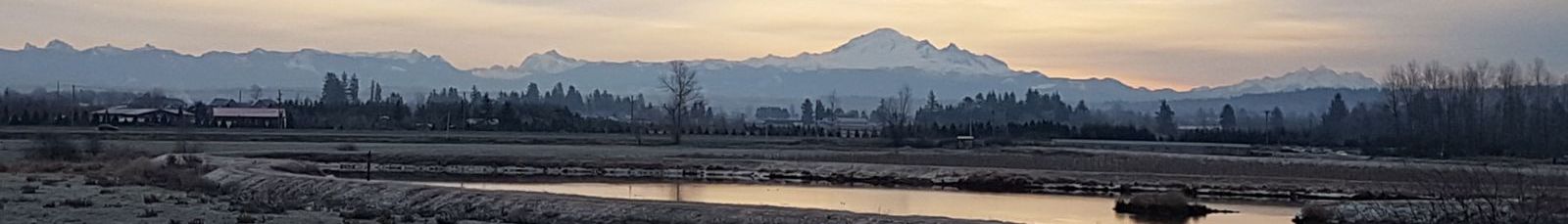
49.052226-122.88550712Crescent Beach,12160 Beecher St,☏ +1 604-501-5050,parks@surrey.ca.Dawn-dusk daily.Enjoy beach time at Crescent Beach located in the neighbourhood of Crescent Beach. The beach extends along the western edge of Surrey from Blackie Spit Park at the north end to almost 24 Ave at the south end. The northern end of the beach is sandy including around and north of Beecher St.Free.(updated Feb 2022)
49.181904-122.82286313Green Timbers Urban Forest,14600 Block of 100 Ave,☏ +1 604-501-5050,parks@surrey.ca.Dawn-dusk daily.One of Surrey's largest parks is about a kilometre from Surrey's city centre. Features numerous forest walking trails and a lake stocked with fish for fishing. Note that fishing requires a provincial fishing licence.Free.(updated Mar 2021)
49.00373-122.75816514Peace Arch Provincial Park,from Highway 99 just north of the Canadian customs, turn west on Beach Road, then turn left immediately after the duty free store building,☏ +1 604-541-1217,peaceparkmanagement@gmail.com.Next to the border with the United States. Have a picnic or meet the American neighbours without having to go through border control. This park connects with Peace Arch Historical State Park on the United States side. Visitors from both sides of the border are allowed to access both parks including crossing the border without going through border control, but it is illegal to go beyond the park boundaries into the other country.Free.(updated Mar 2021)
Part of the fairy forest within Redwood Park49.035985-122.72504315Redwood Park,17900 200 Ave,☏ +1 604-501-5050,parks@surrey.ca.Dawn-dusk daily.Contains a grove of redwood trees. There is also a fairy forest with hundreds of fairy houses.Free.(updated Jan 2022)
There are many golf courses in Surrey. Several PGA tournaments have in the past been hosted in Surrey and parts of the movie Happy Gilmore were shot here.
49.124664-122.76499822Northview Golf and Country Club,6857 168 St,☏ +1 604-574-0324.The two golf courses were designed by professional golfer Arnold Palmer. The PGA had tournaments at this course for 7 years, ending in 2002.(updated Mar 2021)
49.133544-122.8455594Newton, King George Blvd between 68 Ave and 78 Ave. 主要购物区,包括 Surrey 唯一的 Costco。 (更新于 2021 年 3 月)
49.149754-122.8655665Payal Business Centre, 8128 128 St. 设有200家商户,包括宴会厅、南亚餐馆、南亚服装店和其他商店。是英属哥伦比亚省最大、最受欢迎的南亚裔顾客光顾的零售区域之一。请注意,在128街南北几条街区内还有许多其他面向南亚裔市场的较小的南亚裔商业中心。 (更新于 2020 年 11 月)
49.170546-122.8901326Surrey-Delta border, Scott Road between 80 Ave and 96 Ave. Scott Road的许多路段两旁是南亚商店和餐馆,尤其是北部的一半。 (更新于 2021 年 3 月)
Surrey has plenty of shops and restaurants, including the largest variety of South Asian ones in British Columbia. Metrotown, British Columbia's most visited mall, is in Burnaby, about 20 minutes ride from Surrey on SkyTrain.
49.047949-122.783947Morgan Crossing,15765 Croydon Dr. 拥有60家商店和餐馆的购物区。 (更新于 2024 年 8 月)
49.03257-122.80198Semiahmoo Shopping Centre, 1701 152 St. South Surrey 地区拥有75多家商店和餐馆的购物中心。 (更新于 2024 年 8 月)
Surrey has many of the standard national and international fast food chains and mid-range family restaurant franchises. Beyond this, Surrey has hundreds of independently-run local restaurants, with a particular focus on sushi, westernized Chinese, and Punjabi food. That said, Surrey's diverse population also allows one to find a surprising number of Mexican, Korean, Vietnamese, and Filipino eateries, as well as more unusual one-offs for the adventurous. For more upscale dining, look to South Surrey.
49.121635-122.84480212Motel 6,6542 King George Blvd,☏ +1 604-591-6001.入住: 下午3点, 退房: 上午11点.提供免费无线网络和停车。室内热水浴缸和桑拿。健身中心。所有客房均配有咖啡机、书桌、吹风机、熨斗和熨衣板。可要求提供带小厨房的房间。允许携带宠物入住。每晚120美元起.(2022年2月更新)
部分萨里地区存在形象问题,被认为有犯罪和毒品问题。然而,与不列颠哥伦比亚省的许多其他城市相比,萨里的犯罪率通常较低。在Whalley和Newton的King George Boulevard附近的几个街区内的犯罪率高于该市其他地区。萨里正试图通过发展新的住宅和商业建筑来重新开发Whalley的Surrey City Centre地区。该市还一直在为Surrey City Centre地区资助基础设施建设,例如将市政厅迁至此处以及建造新的主图书馆。在这方面,Surrey City Centre地区正处于转型阶段,尽管新的百万美元开发项目如雨后春笋般涌现,但在某些情况下,同一街区内仍可能发现无家可归者和毒品交易。与美国类似大小城市中更严峻的地区相比,萨里没有哪个地区的情况非常糟糕。


.jpg)


.jpg)


.jpg)


.jpg)